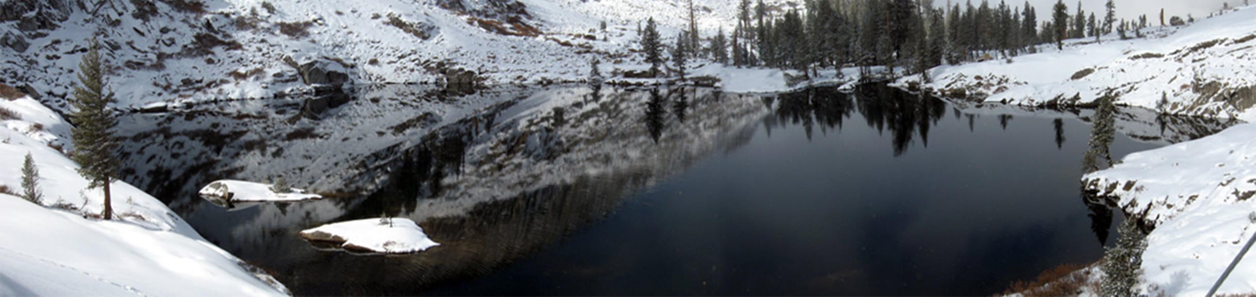
Physiography of the upper Marble Fork of the Kaweah River
The headwaters of the Marble Fork of the Kaweah River (36° 36' 22"N, 118° 40' 59"W) are located in the Tokopah Valley of Sequoia National Park. The Tokopah Valley includes the Emerald, Pear and Topaz lakes basins which, along with several other small ponds and lakes, comprise 30 ha of the basin's 1,908 ha drainage area. The river is a second order stream where it is gauged near the mouth of the valley (elevation 2,621 m). The highest point in the watershed lies at an altitude of 3,493 meters. The V/A index for the Marble Fork watershed is small, suggesting that lakes and ponds in the basin have little influence on river discharge or chemistry. The river will stop flowing during dry years leaving trout isolated in small ponds and pools making easy pickings for bears and coyotes.
The geology of the Tokopah Valley is dominated by fine and medium-grained, porphyritic granodiorite and coarse-grained granite. Most of the basin is composed of bedrock and talus but there are significant areas of Wet Meadow Soils in upper portions of the basin (i.e., Table Meadows) and along the margins of the river-course. Trees, mainly Lodgepole Pine and Western White Pine and willows, are found along side the river as it meanders through the valley. The higher elevations of the catchment, including the upper portions of the Pear and Emerald lake watersheds, have sparse vegetation composed primarily of sedges and grasses.
Brook trout have been observed in the Marble Fork River but appear to be restricted to reaches below the confluence of the Pear Lake outlet. Just above this confluence the bed of the river is composed of steep, smooth bedrock. Rapid and turbulent flows occur during snowmelt and under low-flow conditions the river fans out over the rock surface, reducing water depths to just a few centimeters. These conditions preclude the migration of trout upstream and may partially explain the lack of fish in the upper reaches of the river and at Topaz and Frog lakes.
Instrumentation
Discharge from the upper Marble Fork of the Kaweah basin is gauged at the Marble Fork station which is located about 1-km up-river from Tokopah Falls. A rating curve is computed from periodic measurements of discharge made from the cable car and other methods. This gauging station is jointly maintained by the University of California, National Park Service and the U.S. Geological Survey. GOES satellite telemetry was added in 2004.
In addition to the met stations in the Emerald and Topaz lake basins, we operate a smaller climate station in the south-central portion of the Tokopah called M3.
Marble Fork gauging station
Established: August 1992
Location: 36.36.30 N, 118.41.06 W, 2,619 m above sea level.
Data records: Continuous - hourly air temperature/humidity, stream discharge, stream temperature, conductivity, soil temperature, and soil moisture.
Data is downloaded hourly via GOES telemetry.
Equipment
⇒ Cable car tram.
⇒ Staff gauge, 2 pressure transducers, 2 thermistor, 2 conductivity sensors, mounted in outflow channel.
⇒ Two soil temperature sensors and two soil moisture sensors placed at 10 cm depth adjacent to stream.
⇒ Two 10 watt solar panels, GOES antenna, air temperature/humidity sensor, 2 IER deposition collectors, and one auto sampler mounted on tramway. Datalogger and GOES transmitter mounted on adjacent tree. ISCO sampler mounted on cable car and used to collect water samples.
M3 meteorological station
Established: March 1994
Location: 36.36.37 N, 118.38.50 W,3,232 m above sea level.
Data records: Continuous - hourly wind speed/direction, air temperature/humidity
Equipment
⇒ 14' galvanized pipe instrument tower mounted to bedrock and large boulder.
⇒ Datalogger, with 10 watt solar panel.
⇒ Instrumentation mounted to tower (height above ground):
→ Anemometer (3.5 m)
→ Temperature/humidity sensor (3.5 m)
(click to view larger)


