Physiography of the Emerald Lake Basin

The Emerald Lake basin (36° 35' 49"N, 118° 40' 29"W) is located in Sequoia National Park along the western slope of the Sierra Nevada. Monitoring at the Emerald Lake basin was begun in 1982. The outlet to the basin lies at an elevation of 2800 m. The 120 ha watershed is granitic with steep slopes (mean slope 31°) and 616 meters of vertical relief. Bedrock is mainly granodiorite with mafic inclusions, aplite dikes and pegamite veins (Sisson and Moore 1987, Clow 1987). Poorly developed soils cover about 20% of the watershed and these are acidic and weakly buffered (Huntingtion and Akeson 1987, Lund et al. 1987).
The soils are principally entisols. The primary clay minerals are vermiculite, kaolinite and gibbsite (Lund et al. 1987). Vegetation in the Emerald Lake basin is sparse (Rundel et al. 1988), consisting of scattered conifers (Lodgepole and Western White Pine), low woody shrubs, grasses and sedges.
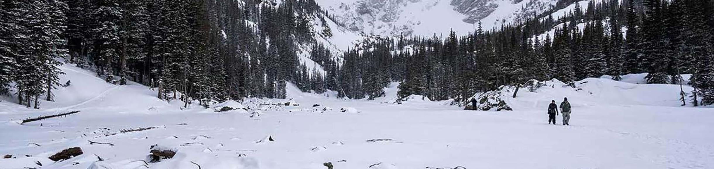
Precipitation in the Emerald Lake basin is strongly seasonal, with snowfall accounting for most of the deposition. Ice covers the lake during the winter and spring and typically persists for 6 to 9 months. Ice thickness and persistence depend on the quantity of snowfall during the winter as well as the frequency and severity of avalanches onto the lake. The thickest ice-cover measured on Emerald Lake occurred during water year 1986 when, due to abundant snowfall and a large avalanche, the lake was covered by 6 meters of slush and ice.

Over 75% of the lake's volume was displaced by ice during the winter of 1986. In other years ice thicknesses ranged from about 1 to 3 meters which represents about 20-40% of the volume of the unfrozen lake. Typically ice-cover disappears by mid June but in extreme snow years (for example, 1983 and 2010) partial ice-cover can persist until mid July or early August.
Emerald Lake is fed by 4 channelized inflows during the snowmelt season; a single, gauged, outflow channel drains the basin. No significant outflow is lost via groundwater or seeps (Kattelmann and Elder 1991). A reproducing population of brook trout are found in the lake and its outflow stream.
Emerald Lake covers an area of 2.7 ha or 2.3% of its watershed. The maximum depth of the lake is 10 meters and the mean depth 6.0 meters. Emerald Lake has a volume of approximately 162,000 m3. At Emerald Lake, 0.14 meters of runoff are required to displace the lake's volume. Hence, in large snow years, Emerald Lake can be flushed more than eleven times.
The lake is dimictic, with spring turnover typically in late May or early June. Fall turnover occurs during September or early October. Thermal stratification is weak during the summer; inverse stratification occurs during winter and spring. Peak summer temperatures in the lake ranged from a low of 11°C in 1983 to 20°C in 1990 and were related to the quantity of snowmelt runoff: higher runoff resulted in lower maximum temperatures. Surface waters in Emerald Lake are well oxygenated year-round.
Instrumentation
Emerald Lake meteorological station
Established: August 1986
Location: 36.35.52 N, 118.40.28 W, 2,808 m above sea level.
Data records: Continuous - hourly wind speed/direction, air temperature/humidity, infrared & total solar radiation, rainfall, soil temperature, soil moisture.
Equipment
⇒ 16' galvanized instrument tower mounted to bedrock.
⇒ Datalogger, with 10 watt solar panel.
⇒ Instrumentation mounted to tower (height above ground):
⇒ Anemometer (5.6 m)
⇒ Temperature/humidity sensor (5 m)
⇒ Infrared (Eppley PIR) & total solar radiation (Eppley PSP) (height above ground level: 5.6 m)
⇒ Sensor bandwidths are:
→ PSP: 0.285 - 2.8 micrometer
→ PIR: 3.5 - 50 micrometer
⇒ Tipping bucket rain gauge (5.9 m)
⇒ Two IER deposition collectors (5 m)
⇒ Soil moisture and soil temperature sensors placed at 10 cm depth in soil 15 m from tower.
⇒ Aluminum dry box for storage of inflatable raft, portable oxygen & temperature meter and lake sampling equipment.

The Emerald Lake weir is constructed of plate steel and attached to a rock foundation. The datalogger in the tree to the left records hourly measurements of stage, temperature and conductivity. |

The Emerald Lake weir and the datalogger during the winter of 2010-2011. At the beginning of the snowmelt season the weir must be dug out and the ISCO sampler installed for collection of water samples. |
Emerald Lake gauging station
Established: July 1985
Location: 36.35.53 N, 118.40.33 W,2,800 m above sea level.
Data records: Continuous - hourly stream discharge, temperature, conductivity.
Equipment
⇒ Weir, staff gauge, 2 pressure transducers, one thermistor, and one conductivity sensor, mounted in the outflow channel.
⇒ Autosampler placed at the weir.
⇒ Datalogger, two 10 watt solar panels, mounted on adjacent Lodgepole pine