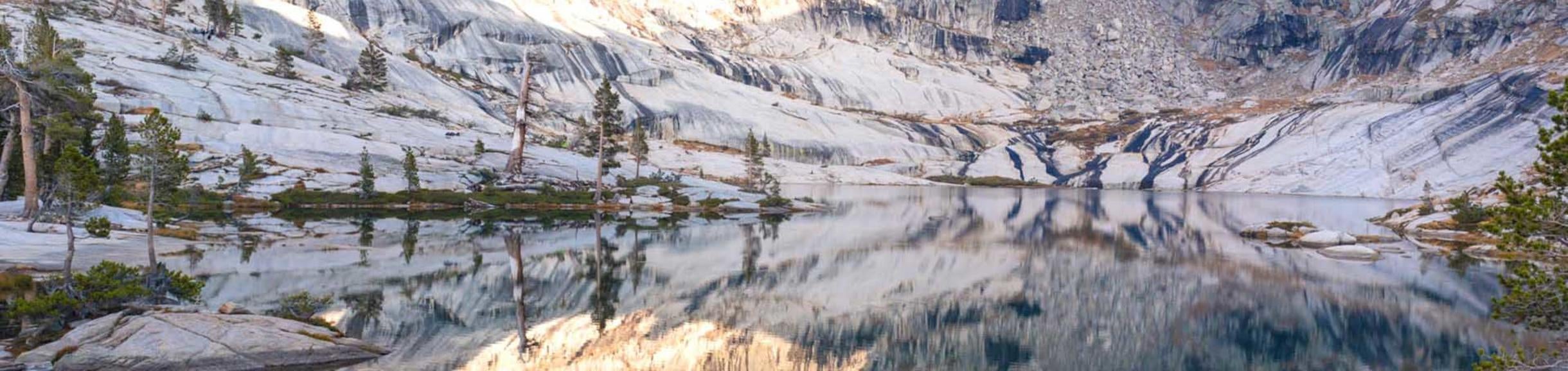
Physiography of the Pear Lake Basin
The Pear Lake basin (36° 36' 02" N, 118° 40' 00" W) is located in Sequoia National Park adjacent to the Emerald Lake Basin. Regular limnological and hydrological measurements began in 1986 and terminated in 1993. Pear Lake is the largest and deepest lake in Tokopah Valley. The lake has a maximum depth of 27 m, a mean depth of 7.4 m and volume of 591,000 m3. Because of its depth, thermal stratification is strong during much of the year and low dissolved oxygen concentrations occur in the hypolimnion. Mixing of the lake occurs during the spring and autumn but can be incomplete; water temperatures at a depth of 25 meters rarely exceeds 5°C. As a consequence, redox potentials are low in the hypolimnion as evidenced by the accumulation of hydrogen sulfide, ammonium, and iron and the low pH in these waters (Sickman and Melack 1989).
The outlet to Pear Lake lies at an elevation 2,904 m and the vertical relief of the drainage basin is 471 m. Owing to the large volume of the lake, the V/A index is high (0.45 m) relative to the other study sites indicating that Pear Lake has a greater influence on outflow discharge and chemistry. The lake is fed by one major inlet stream during most of the year, but probably receives a significant portion of snowmelt from sheet flow off of extensive areas of exposed bedrock surrounding the lake. The outlet typically flows year round, but can dry up when snowfall is low and non-winter precipitation light (e.g., 1987-1990 drought).
Most of the Pear Lake watershed is composed of coarse-grained granites containing sparse mafic inclusions of widely variable size and texture. The remainder of the basin is underlain by medium-grained, porphyritic granodiorite (Sisson and Moore 1987). Greater than 90% of the catchment is composed of bedrock, talus and boulders. What little vegetation is found in the basin consists of a few stands of coniferous trees (Lodgepole Pine, Western White Pine, Red Fir), shrubs, grasses and sedges. Soils, where present, are classified as entisols.
Figures: Aerial oblique view of the Pear Lake catchment and bathymetric map of Emerald Lake [click to enlarge].


